


Garmin Tread - Base Edition
Couldn't load pickup availability
Visit our Clearance Section for a Great Deal on the Garmin Tread Base Edition
ROAM THE UNKNOWN.
This rugged powersport GPS navigator keeps you on track. Take your side-by-side off the beaten path with topographic mapping, private and public land info, forest service roads and trails.
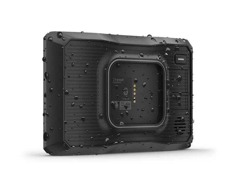
The rugged Tread off-road GPS is IPX7 weather-resistant and features a glove-friendly 5.5” touchscreen display.
Use the Tread® app to sync data across your various devices.
Direct-to-device BirdsEye Satellite Imagery can be downloaded to Tread without a computer.
Easily install on your powersport vehicle with the included powered mount and wiring harness with tube mount.
Key Features:
OFF-ROAD RUGGEDNESS Purpose-built for all-terrain use, Tread stands up to anything the elements can throw at it. It’s IPX7-rated for water-resistance and built to U.S. military standard 810 for thermal and shock resistance.
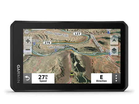
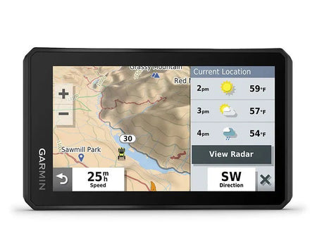
HIGH-VISIBILITY DISPLAY With its ultrabright 5.5” glove-friendly touchscreen, the Tread navigator is designed for easy viewing in bright sunlight or pitch dark. It can be mounted in portrait or landscape mode.
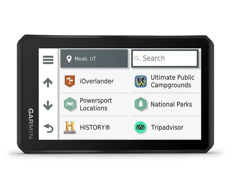
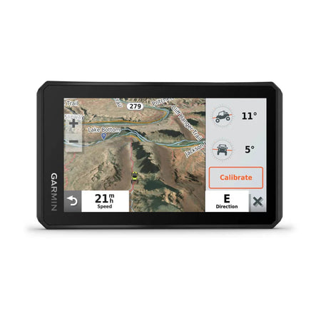
TRAIL NAVIGATION Enjoy turn-by-turn trail navigation for traversing unpaved roads and trails using Adventure Roads and Trails map content comprised of OpenStreetMap™ and USFS Motor Vehicle Use Maps.
MAPS ON AND OFF-ROAD Tread features preloaded topographic maps of North and Central America and detailed street maps of North America. It also includes U.S. Forest Service Roads and trails and Motor Vehicle Use Maps (MVUM) for full-sized 4x4s, side-by-side, ATVs and motorcycles.
SATELLITE IMAGERY Download high-resolution BirdsEye Satellite Imagery directly via Wi-Fi® connectivity, with no annual subscription required.
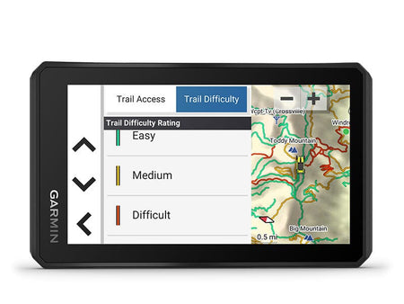
TRAIL RATINGS Our growing trail database now includes difficulty ratings for off-road riding areas, where available, across the U.S.
POINTS OF INTEREST Tread comes preloaded with iOverlander™ points of interest and Ultimate Public Campgrounds, so you don’t need a cell signal to route to the best-established, wild and dispersed campsites.
KNOW YOUR BOUNDARIES Access public land boundaries for national forests, Bureau of Land Management (BLM), wilderness areas and more. Also, see private land boundaries and landowner information for parcels greater than 4 acres.
EASILY SYNC YOUR DEVICES Use the Tread app to sync waypoints, tracks, routes and collections across your devices, including your mobile device, computer and Tread navigator. Easily import and share GPX files, too.
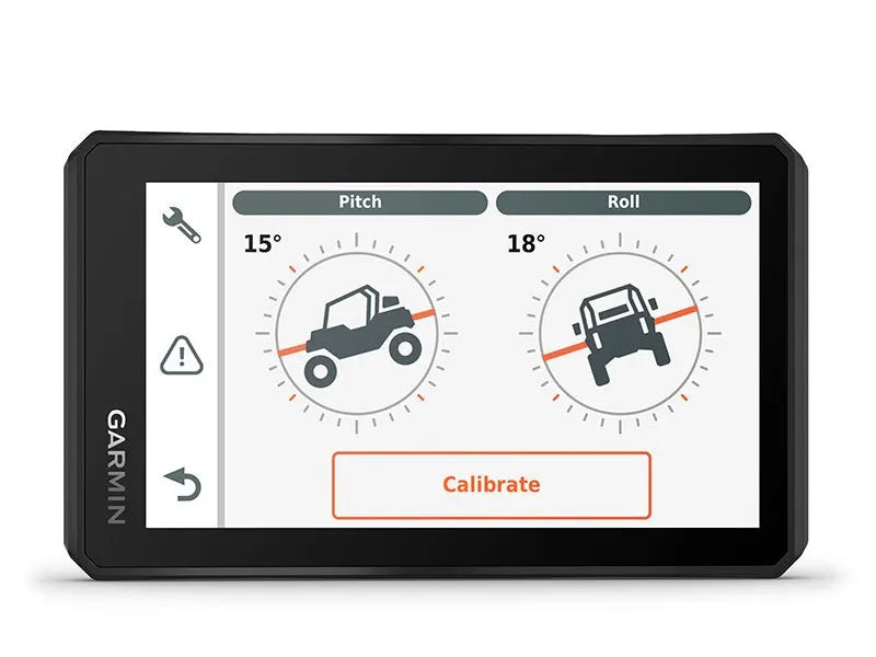
ABC SENSORS For tough-terrain guidance, built-in sensors include an altimeter, barometer, compass and pitch/roll gauges.
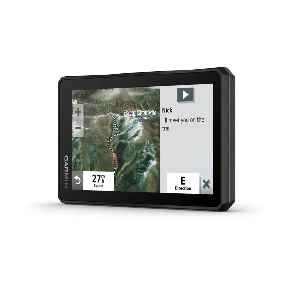
INREACH® COMPATIBLE Pair your Tread powersport navigator with one of the compatible inReach global satellite communicators (sold separately) for two-way text messaging, interactive SOS and weather.
GO-ANYWHERE GUIDANCE Get spoken turn-by-turn directions if you choose to take Tread with you when you head back to civilization and want on-road navigation. Includes driver alerts for sharp curves, red light/speed cameras and more.
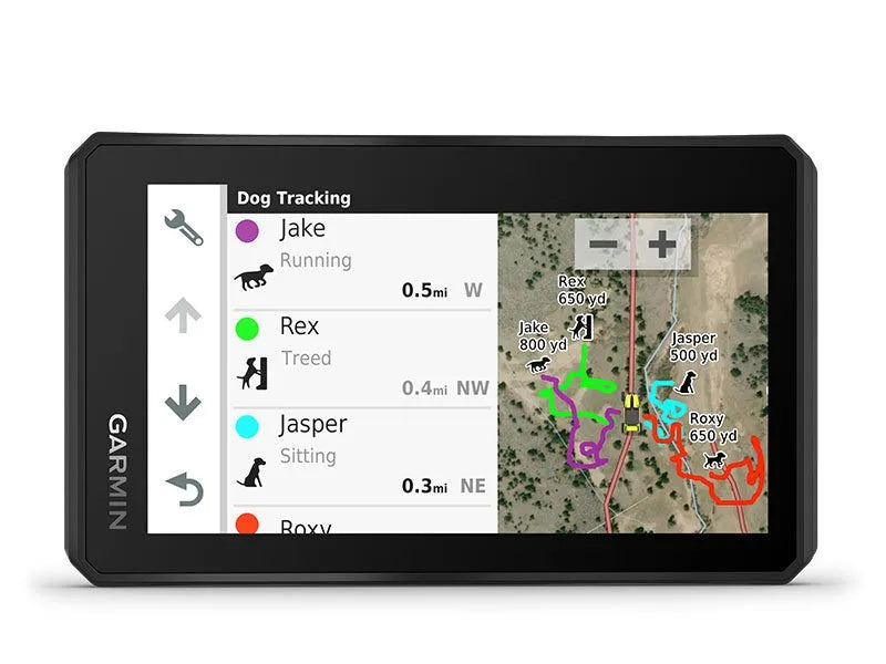
DOG TRACKING Wirelessly pair Tread with select Garmin GPS dog systems (sold separately) to help track and retrieve your dogs in the field. You’ll see markers for each dog within tracking range, overlaid right on the navigator’s map screen. Directional cues help you easily follow and locate each dog you’re tracking.
Includes:
• Tread
• Trim ring kit (blue, black, red and green)
• Tube mount kit
• Power cable
• USB cable
• Documentation
Product Specs:
Dimension: 5.8”W x 3.5”H x 1”D (8.8 x 14.8 x 2.4 cm)
Display Size: 4.8”W x 2.7”H (12.1 x 6.8 cm); 5.5” diagonal (13.9 cm)
Weight: 9.2 oz (262 g)
Battery Type: Rechargeable lithium-ion
Battery Life: Up to 6 hours at 50% backlight / Up to 1 hour at 100% backlight
Memory Storage: 256 GB max microSD™ card (not included) / 64 GB (internal)